Kinnaur Kailash Trek Distance might not look very impressive on paper, but this trek is truly one of a kind.Anyone that’s done it will no doubt say the same. The pilgrims don’t wear shoes and mountaineers, well they use crampons to get over the journey but both ultimately walk up the same narrow path to the same holy site, this is all you need to know about the Kinnaur Kailash Yatra.
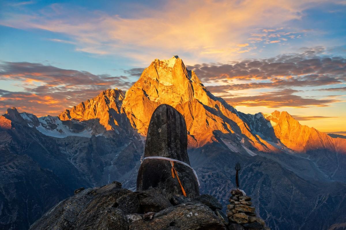
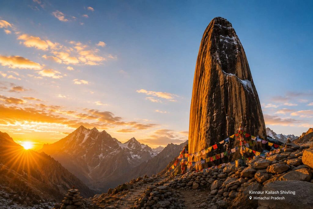
The target is a 79-foot natural Shivling at 4,800 metres, one of the Panch Kailash Yatra, sacred to both Hindus and Buddhists, believed to be Lord Shiva’s winter home.The first practical question always posed by people intending to make the trip is the length of the Kinnaur Kailash trek. Depends on the route taken and acclimatisation.This guide breaks it down clearly.
check previous blog : Kinnaur Kailash Height in Feet
Kinnaur Kailash Trek Distance: The Clear Answer
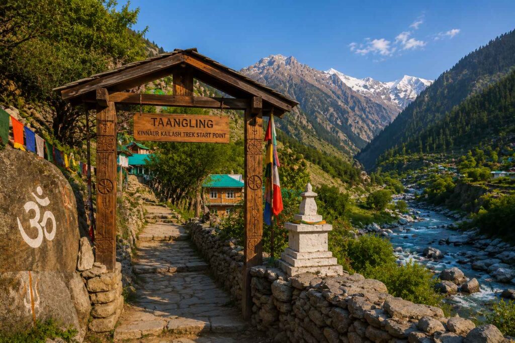
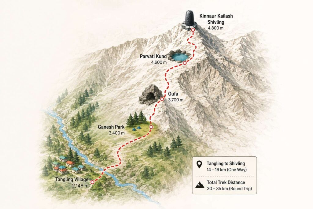
The general and easiest way to Kinnaur Kailash Shivling begins from the village of Tangling. Tangling to Kinnaur Kailash Shivling’s one way distance would be around 14-16km and returning through the same path. Hence the distance for trekking would be around 30-35km in 3 days.
Or alternatively trekkers could start their treks from any other of the approach points such as Powari, which is slightly longer and might be 19-20kms one way. This path meets the main path just before reaching Parvati Kund. Overall pilgrimage trek is between 30-35kms covered by the majority of the trekkers from any of the points.
A typical day’s trekking here is of 8 to 12 km depending on the section. The first day is more lenient.The altitude combined with the gradient on day two makes every kilometer feel like two.
Next up, there is the major one-the Kinnaur Kailash Parikrama circuit, through Charang La Pass (5241m), about 80km in length, that takes about 5-7 days to complete. The old route was over 200 km! Only for fit trekkers, who have done high altitude treks over 4000m before.
check another blog : Spiti Valley to Kaza Distance
Day-Wise Breakdown: Kinnaur Kailash Trek Distance Route from Tangling
This is by far the most popular route to undertake by pilgrims and trekkers. This is what the day will be like on the ground.
Day 1 — Tangling Village to Ganesh Park
Distance: 8 to 10 km | Altitude gain: 2,148 m to ~3,400 m
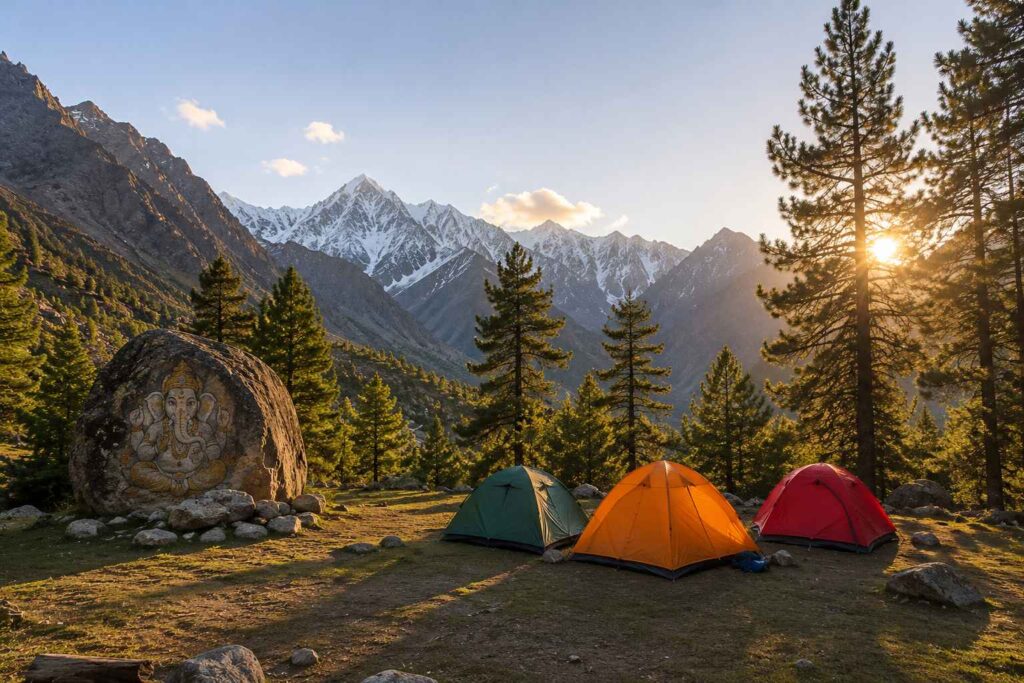
The village is located on the left bank of the Sutlej river, some 11km before Reckong Peo when coming along NH-5. Almost immediately after the start the walk goes up a steep slope through pines and oaks. Midway, Ashiqui Park, a flat open area with shady trees is the place to halt. Ganesh Park-which gets its name from a rock looking so like the Hindu god-is the village and place of overnight halt (3,400 m). Remember your jacket-as the temperature plummets with sunset (by about 5 p.m).
Day 2 — Ganesh Park to Kinnaur Kailash Shivling via Gufa and Parvati Kund Distance: 6 to 8 km | Altitude gain: ~3,400 m to 4,800 m
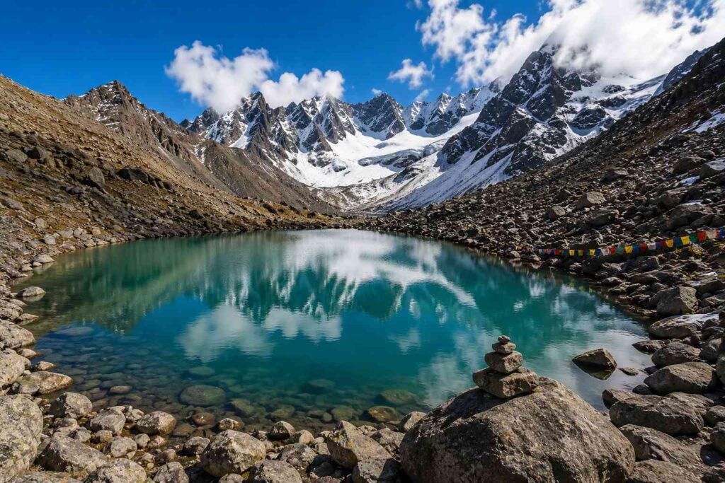
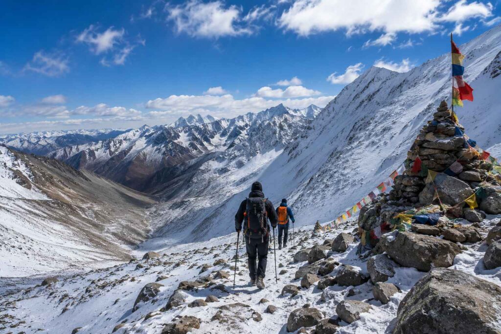
This is the day the trek reveals its real character. The trail becomes rocky and the gradient stops being gentle. Gufa-large natural rock overhang cave-is at approx. 3700m and is where a second stopping point stay for the night. From Gufa on, the scenery opens out considerably and trees disappear. From Gufa, enormous rocks replace trees, and the air becomes noticeably thinner. The small glacial Parvati Kund at approx. 4600m is suddenly almost unavoidable. It’s breathtaking and quite disorienting all at once. From here it is a last few hours to the Shivling itself (4800m). You will instinctively stop walking when you see it for the first time.
Day 3 — Descent Back to Tangling Distance: 14 to 16 km
Same trail, opposite direction. Descents on boulder terrain punish the knees more than the climb punished your lungs. Use trekking poles. Budget 6 hours for a safe return.
check another blog : Spiti Valley from Chandigarh
The Charang La Parikrama Circuit — For Experienced Trekkers Only
For those who want the complete sacred loop around Kinner Kailash, the Parikrama circuit via Charang La is the route. It is longer, higher, and far more demanding.
Day 1 is a road drive from Shimla to Charang village. Day 2 is full acclimatization. Day 3 covers Charang to Lalanti. Day 4 goes to Charang La Base Camp. Day 5 is the pass crossing at 5,241 meters down into Chitkul. Day 6 is the road back to Shimla.
Total distance: approximately 80 km. A local guide is a safety requirement, not a suggestion, on this circuit.
Getting to the Kinnaur Kailash Trek Starting Point
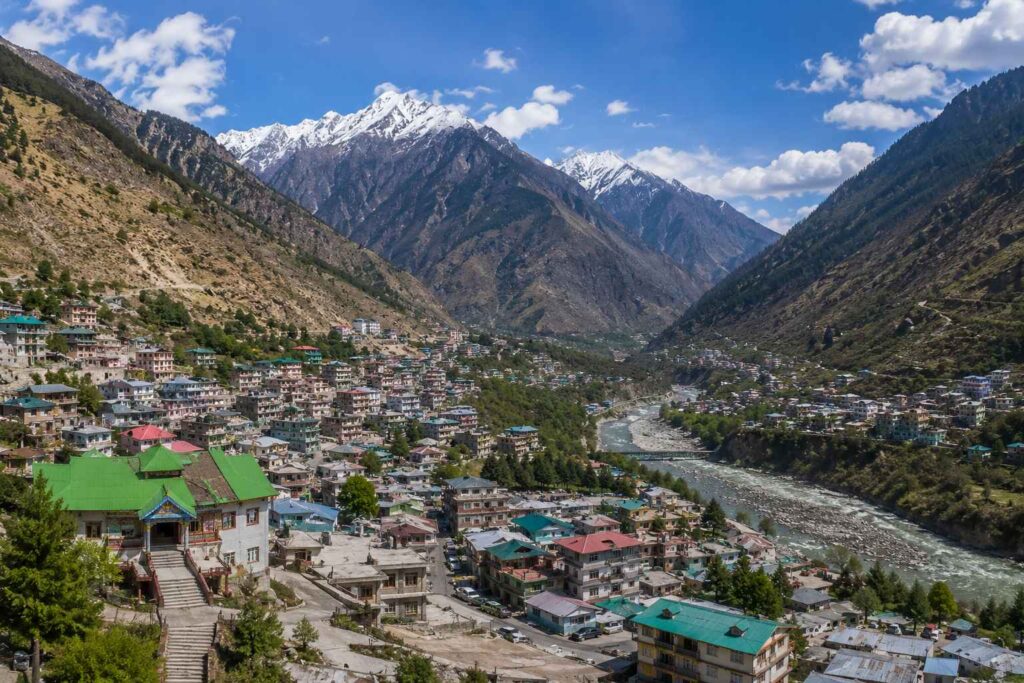
It takes about 250 km (8-9 hrs) on the road to Tangling village from Shimla via Sutlej Valley highway. Reckong Peo is the last place where there is an ATM, a chemist, mobile recharge and a network signal. Stock up here — nothing essential is available beyond this point.
The trekkers from Delhi came down to Shimla via night bus and then took a taxi to reach the place further beyond Shimla. Trekkers from Chandigarh also reached up to Chandigarh only and took the taxi further as it is quite a distance of about 350 km from Chandigarh to Reckong Peo.
Best Time for the Kinnaur Kailash Trek in 2025
For this year the official Kinnaur Kailash Yatra begins from July to August . It has been declared a new age limit for registering for the Yatra for this year between 16 and 60 years.Only 350 registrations are allowed each day, which will be further distributed between online and offline slots and the adventure tour operators.
Out of the stated season, the trail runs from May to October. May and June can still have snow over 4000 meters. September and October have the best clarity and views – for most of the veteran trekkers this is when to do the walk. July and August risk monsoon rains on approach roads; never leave home without checking road access of landslides on NH-5.
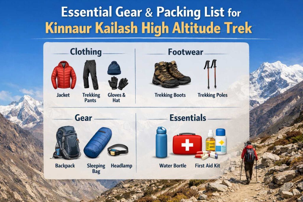
What to Pack and What to Know Before You Go
Get a pair of waterproof high-ankle trekking boots. The ground near Gufa where there is huge rocks will tear down any low cut shoe or a trail runner.Wear base layers thermal, then fleece, and finally wind proof jacket. You should consider temperatures around 0C at nights even at Shivling in August.
Carry a sleeping bag that is rated up to -5C, trekking poles, headlamp and spare batteries, and a first aid kit: Crocin, Diamox (if prescribed by doctor), bandages and sun-block-sun radiation is intense over 4000m even on cloud days. Mobile signal disappears (virtually) at Reckong Peo so use an offline maps app such as Maps.me or Gaia GPS before you lose signal. Inner Line Permit required-no. For the Shivling trail, just carry a government ID for check points on the road leading to it.
One Last Thing Worth Saying
The distance for most Kinnaur Kailash trekkers along the Tangling route is 30-35km (depending on route). The distance looks less than the walk to your local town on a map, but due to altitude and the extreme terrain it is so much harder than it seems. And in physical terms (the part that matters) with correct training it really isn’t: there is no city park run in your local hometown that can prepare you for 8km through the Tibetan plateau at 4500m with 15kg on your back.
It also doesn’t prepare you for the silence when you finally reach the Shivling, just after dawn, standing surrounded by crisp air and stark mountains, and silence that actually has a texture. No matter whether you’re there for the darshan, the trek, or both.
Start fitness prep 6 to 8 weeks out. Focus on uphill cardio with a loaded pack. Register through official channels. Hire a local guide for your first high-altitude trek.
On day 2, when you are panting hard at Gufa and your legs are raising a lot of question – just continue. Each km is going to be worthy.

 Admin
Admin 
[…] Kinnaur Kailash Trek Distance on the main route is 17 to 19 km one way — a full round trip of roughly 38 to 40 km on foot. The […]